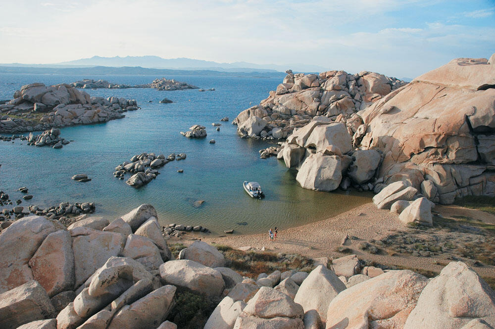
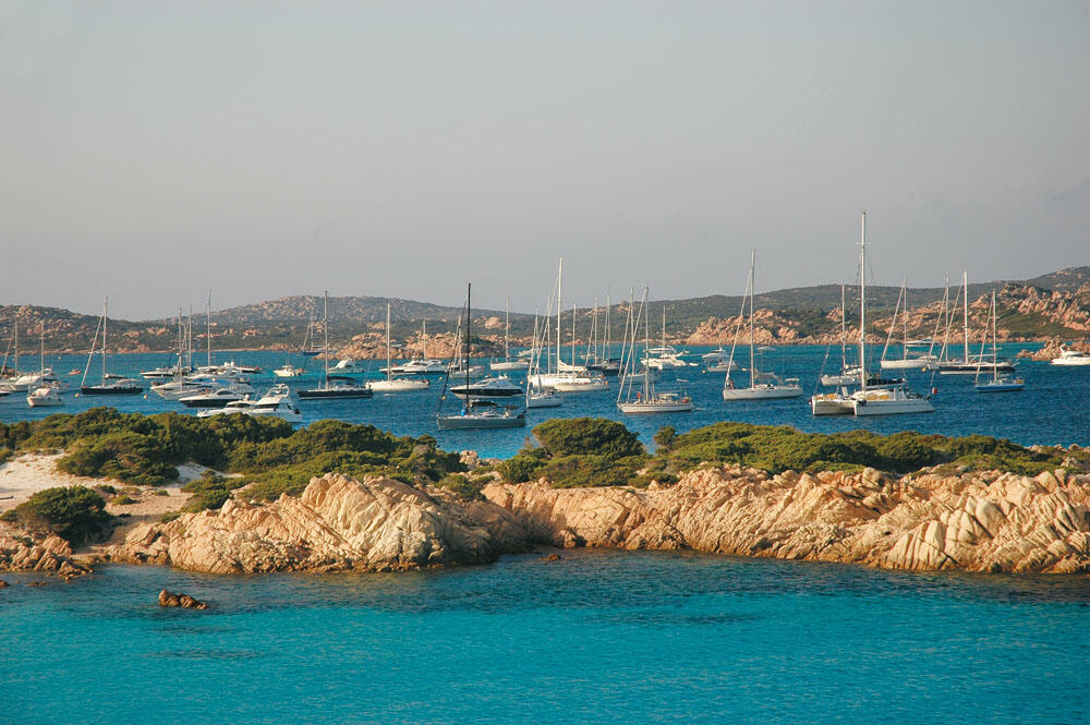
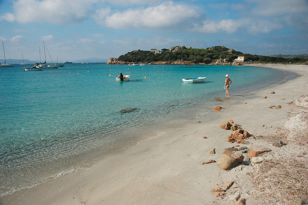
In the islands of the Lavezzi Archipelago
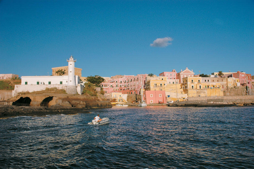
Pontine islands
In the islands of the Lavezzi Archipelago
Pontine islands
Approaching the Archipelago of Maddalena at rough sea
Our bow turned to 270 degrees and was heading Lavezzi islands, which are located at the Strait of Corsica, at 173 nautical miles.
The weather reports gave west-northwest winds, with an intensity of 3 to 4 Beaufort. We had before us the last long passage of the journey, and all our senses were tense. I had plotted our course on both the GPS and the nautical chart while rechecking the compass reading. We were traveling at 25 knots, the engine was working at 4,500 rpm and our consumption reached 45 liters per hour.
In the Tyrrhenian Sea
10:45am: We have already booked an hour's journey and our bearing was B 41° 15' 66 A 12° 38' 97.
The weather found us wide open, not exceeding 4 Beaufort. Although the inflatable had no problem, with its waterline carving the waves and setting its own pace, we slowed down a bit because the miles ahead were many. The coasts of Italy began to disappear behind us and the Tyrrhenian sea was taking us for good in its arms. Everything looked great, and with smiles on our faces we were enjoying our sailing on the open sea.
11:45am: Our bearing was N 41° 15' 45 E 12° 16' 96. Although the weather remained steady, our speed had considerably reduced and we still had 136 nautical miles to go. We were especially happy because the journey was still at its beginning and the vast blue filled our horizon.
Wherever we looked the gaze was lost and the only point we could focus on was the horizon line that surrounded us, where the deep blue of the sea seems to blend with the blue sky. No boat or ship was in sight on our course, and so we were plunged into the solitude of the voyage. We were but a small dot moving westward in the vastness of the sea.
12:45pm: The wind began to send us big, dumb waves, which forced us to cruise at 16 knots for smooth and sweet sailing. Not that we could not go faster, but on a long voyage the primary objective is to travel as leisurely as possible, so as to conserve our strength in case the weather worsens, but also to put less strain on the boat's lever and rudder. Thus, the engine worked effortlessly at 3,650 rpm, but our consumption reached 35 liters per hour. Our bearing was N 41° 15' 78 E 11° 51' 21 and we still had 120 nautical miles to go.
1:45pm: The silent waves grew in volume and began to become unruly, making our sailing more difficult. Our speed dropped to 15 knots, engine revs to 3,500, while our consumption remained high, reaching 34 liters per hour. We managed, however, to keep steady on our marked course, which was evident from our bearing, which was N 41° 15' 79 E 11° 37' 18. After four hours' voyage we were in the same latitude, which differed only some " seconds' of fate, compared to its principle. But we had covered only 67 nautical miles and still had 106 to go to our destination.
15:45: The next two hours did not offer us any change in the weather, with the only difference being that it was clearly visible that the silent waves began to find their lost periodicity again. In this time we covered another 27 nautical miles, and we now had 74 more to go. Our new bearing was N 41° 17' 56 E 10° 54' 96.
16:45: Suddenly the sea changed its face. It became so smooth, without the slightest wrinkle, and we seemed to be traveling on a vast glass surface. The restia, while still existing, appeared to be stationary, and the whole ocean seemed to pulsate. A shocking, as well as eerie sight unfolded before our eyes. At some point the visibility decreased considerably and the scene around us became even more mysterious. Apnea and extreme heat made the sea look like it was evaporating, and maybe that was the reason for the limited visibility.
Of course, our speed increased considerably, reaching 23 knots, with the engine now working at 4,000 rpm and our consumption at 41 liters per hour.
Our bearing was N 41° 16' 33 E 10° 28' 92 and we still had 55 nautical miles to go. Despite the incredible beauty that this rare image of the sea gave us, I confess that inside I felt quite tight. At the back of my mind there were some question marks and without realizing it I found myself "stealing" the compass a bit and the inflatable getting quite high from our charted course. So this incredible oil and the absolute peace of the wrinkled sea that seemed to evaporate, on the one hand had captivated me while on the other hand it made me think. Could this otherwise delightful mid-ocean restia be the product of some storm brewing a few miles ahead?
As many times as I have traveled to the western Mediterranean and been confronted with similar Mediterranean vagaries, something bad happened after a while. This feeling of mine grew even more when I realized that, not only were we approaching the Strait of Corsica, but we were also directly opposite it.
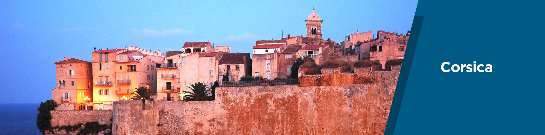
In Corsica!
5.45pm: We were now traveling at 22 knots, at 3,800rpm, consuming 37 liters per hour. Our bearing was N 41° 17' 39 E 10° 03' 60, and we were only 36 nautical miles from our destination.
Land could not be seen ahead, but we knew that the inflatable was coming wide of the Corsican strait. Some wrinkles began to appear on the flat ridges of the silent waves which soon developed into small crests, a sign that we would soon have a change in the weather.
Indeed, we did not manage to make any miles, and the peaks began to rise and break under their weight. In no time the whole sea turned white and, before we fully realized what was happening, we found ourselves in a real mess! And while the entire Tyrrhenian sea was anesthetized, the bugazzi of Corsica produced snakes...
Like every bugazzi, it has its own distinct seasons and no weather report can ever predict them. It was the first time we came face to face with him and we lived an unprecedented experience. We stood for a while, crawled into our niches and closed them tightly. We were ready to dance to a different rhythm and get a good taste of the bloodiness of this strait. "Prepare to fight" I exclaimed, and with our morale high we charged into the weather. Two back-to-back knocks, however, quickly put us in our place.
The blanket was flooded with living sea, as the water rushed like a torrent against the side rails of the small cabin. Both bilge pumps were immediately started, and the ship's logbook was tossed into the cabin. Our notes and numbers now took second place.
The entire horizon took on a gray appearance and the leaden sea showed us its worst face. We started reading the waves trying to find their weak spots so we could exploit them and be able to achieve a laminar ride. We desperately searched for passable passages between them, but the waves carried so much energy in their wakes that our every attempt resulted in free falls. The bugles were incredible but we weren't too concerned as we had eaten so much water that we were dripping everywhere.
18:45: With my attention turned to steering the boat, with quick glances at the GPS I was finally able to see that we still had 25 nautical miles left. The sea was already rough and I was sure that the closer we got to the Corsican Strait the worse it would get. But we insisted on staying on our course, despite the "wood" we were eating.
Our speed was now non-existent and we were traveling aimlessly through the antara. The waves were hitting us with a demonic intensity and their height had now taken on threatening proportions. Their length was not so short that it had trapped us and we could not find a way to react. The crests of the waves were bursting from everywhere, and every effort we made was a complete failure.
The timing became extremely difficult and scenarios of changing our course began to form in my mind. Besides, at this speed we would reach the Lavezzi Islands in the evening, which I did not wish for even in my worst nightmare. It is enough to take a look at the nautical chart and we will be left speechless by the countless times these islets live. A veritable minefield of reefs and shoals, the like of which exists nowhere else in the Mediterranean. And of course I didn't want us to get trapped in there under any circumstances.
We were all staring straight ahead and searching the gray horizon for land. We shouted loudly so that we could be heard with Spyros and Fotini, and after a very short dialogue we decided to turn our bow further south. It was now obvious that these few remaining miles would be covered with great difficulty. We had been traveling all day and the danger of running out of strength was now visible.
Forced change of course
Our bow now pointed somewhere towards the Maddalena Islands, which are off the north-east tip of Sardinia. We had put the weather on our starboard mask but the situation did not improve much as the torrential waves continued to plague us...
I don't know how many Beauforts we were up against, but there are some seas where the numbers don't matter at all and in no way give the real picture out there. Sure, the weather was over 6 Beaufort, but that wasn't the problem. The waves were so impetuous and abrupt, and their ridges so vertical, that they left us no room for steering. We could not go quickly, for it was certain that we would not be able to hold on to the inflatable, but even our slow sailing was an excruciating torture, with the waves taking us wherever they wanted.
The whole sea was boiling and the crests of the waves were breaking on our starboard mask and turning violently inside the inflatable. All we could do was bend down and close our eyes to each "attack" of the waves. Finally, we were forced to turn our bow even lower. We forgot our destination and all we cared about was getting out of this mess as soon as possible.
At some point, some mountain masses began to fade into view, which acted as a redemptive injection of morale.
I kept a close eye on the compass and noticed that it was only when our bow had turned 35 degrees south of our original course that our sailing began to flatten somewhat.
Of course, on these courses we were driven much further south, even from the Maddalena islands.
As I discerned to our right the scattered massifs of these islands, I made some last efforts to mark them with my bow. But it was really impossible. The sea looked like a menacing beast that was incredibly angry. So I gave up and steered the inflatable, heading for the Sardinian coast. We had only 15 nautical miles left which, however, seemed endless. Our only object now was to reach land before night overtook us...
It was dusk now, and we could see several boats moored behind a cove. This showed us that the sea would be calm there. We turned towards them and didn't care where we were. All we wanted was to splash around in a peaceful cove and make a hot coffee.
Indeed, in a short time our long torturous sailing came to an end and the anchor chain was dragging towards the bottom. The waters here looked like a lake and that was the nicest thing that could have happened to us. None of us was in the mood to look at the map to see where the sea had taken us. We put on warm clothes, quickly brewed our coffees, and sat on the stern cushions. Speechless, we sipped the hot coffee so delightfully, without wanting anything else. Those sips of coffee were worth all the gold in the world to us. Even if they were bitter, because we had been spared the sugar. We had eaten so much sea that we felt like we were now in the most beautiful part of the world.
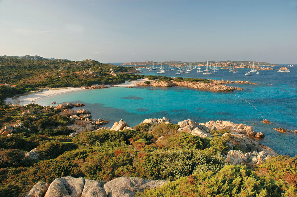
On the Emerald Coast!
The next day dawned and none of us would budge from their corner. We were so tired that we refused to leave our warm sleeping bags, even though our eyes had been open for some time. It was only when the sun had risen quite high that there began to be some movement on deck. After drinking our morning coffee, our conversation turned to the adventurous sailing of the previous day, while we were now sitting comfortably on the sunbeds, enjoying the absolute tranquility of the bay.
This, my friends, is the sea after all: extremely dishonorable, but also unspeakably sweet! One time he tries to drown you and the other time he takes you to heaven, giving you fairytale moments and images. And we, in just a few hours, vividly experienced both of her faces. Now safely nestled in the warmth of our leeward cove, we enjoyed swimming in the calm waters for a long time and soaked up these unique moments with all our senses.
At some point we opened our maps and books and found that the sea had taken us to one of the finest areas of the entire Mediterranean. On the famous Emerald Coast or Costa Smeralda (as the entire north-eastern coast of Sardinia is known).
The irony is that we found refuge on Paddha Beach, which is located on the western side of Pevero Bay, just below the famous Porto Cervo.
Without it being in our travel plans, since we were here due to bad weather, we would not let the opportunity go to waste, since the Emerald Coast is one of the most famous destinations in the whole world.
Apart from the infrastructure works that have been done, the "Emerald Coast" has very beautiful lacy shores that form successive bays, white sandy beaches and wonderful waters.
Another reason that makes the Emerald Coast stand out as a holiday destination is that it is a breath away from the islands of the Maddalena archipelago, the Lavezzi islands, and of course from southern Corsica and the unique Bonifacio. In an area of only 20 nautical miles are gathered all the above destinations which, without any doubt, are at the top of the list of the most beautiful areas in the Mediterranean.
In this maritime area, from the Costa Smeralda of Sardinia to Bonifacio in Corsica, we will meet entire fleets of yachts, many of which are among the largest and most expensive in the world. And of course what really impressed us was that many yachts also had their own helicopter, which had the role of tender, for their rich owners. Something that, after staying for a few days in these places, became a common image for us.
Costa Smeralda's fame has spread to the ends of the earth since 1962, when a large group of foreign investors, led by Prince Aga Khan, allocated huge capital to create a lavish resort catering to people of "high society".
Since then, entire areas have been transformed, ultra-luxurious hotels and impressive villas have been built, vast areas have been laid out, model villages have been built, and large and fully equipped marinas have been constructed along the coasts, with the result that within a few years the entire northeastern coast of Sardinia has become one of the most famous destinations in the world.
The implementation of these ambitious projects was entrusted to famous architects and the result is truly unique. Each construction is perfectly harmonized and compatible with the environment and the natural landscape of the area, down to its last detail. It is characteristic that entire settlements built on the slopes of low hills cannot be distinguished unless you get very close, and you often have to observe very carefully to distinguish the houses that are located between the rocks and are painted the same color as them.
Nowadays, many famous artists, singers and actors have bought holiday homes on the Costa Smeralda, whose expensive marinas are filled with ultra-luxury yachts and large designer yachts.
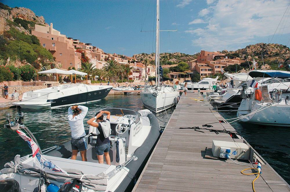
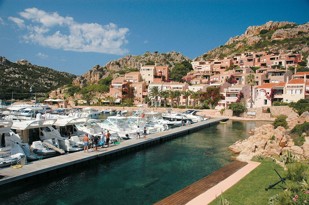
Porto Cervo bay tour
After we had rested enough and regained our strength, we moved to the cape that was located a mile further north from the beach where we spent the night, after which the entrance to the bay that hosts Porto Cervo opens. Passing only a few meters from the mouth of the long narrow bay, which penetrates for a kilometer inland, we found ourselves in a magical place where everything seemed like a fairy tale.
To our left lay a lovely settlement, sloping down the smooth slopes of the low hills of the bay, its houses painted in the same earthy colors to match perfectly with the brown rocks of the shore. To our right, nestled in the dense vegetation, were stunning villas, all low-rise and tiled roofs, whose large gardens with colorful flowers sloped down to the sea where the owners' private dachas are located.
Everything is so tasteful, and above all without exaggeration, made exclusively from local ingredients, emphasizing their genuine Mediterranean architecture. It is obvious that every construction follows strict building rules, which are in complete harmony with the natural landscape. The opulence is reflected everywhere, but in a very elegant way, which not only does not disturb, but on the contrary fills you with very beautiful feelings. Porto Cervo is the heart and mirror of Costa Smeralda, it is the center of the wider area and one of the most beautiful resorts of the Mediterranean.
Shortly after the bow, on the south side of the bay, is the port, while at the bottom of the bay we find the large and impressive marina. In the summer months the entire marina turns into an impressive catwalk of ultra-luxury yachts, and certainly here we will meet many of the most expensive yachts in the entire world. And of course the walk around the marina is an unforgettable experience. Wonderful shops of famous houses, beautiful cafes and restaurants among unique luxurious buildings, make up an incredible place that cannot but fascinate every visitor.
Arriving at the beautiful church "Stella Maris", where there is also a painting by El Greco, we will admire the magnificent view of the marina which is without a doubt a jewel of Sardinia and one of the most beautiful marinas in the Mediterranean.
Considering ourselves very lucky, as visitors and especially as captains, to have had the opportunity to anchor and tie up in this fairytale place, we slowly left the port of Porto Cervo without yet realizing that just a short while ago we were experiencing some of our most beautiful sea experiences.
In the La Maddalena archipelago
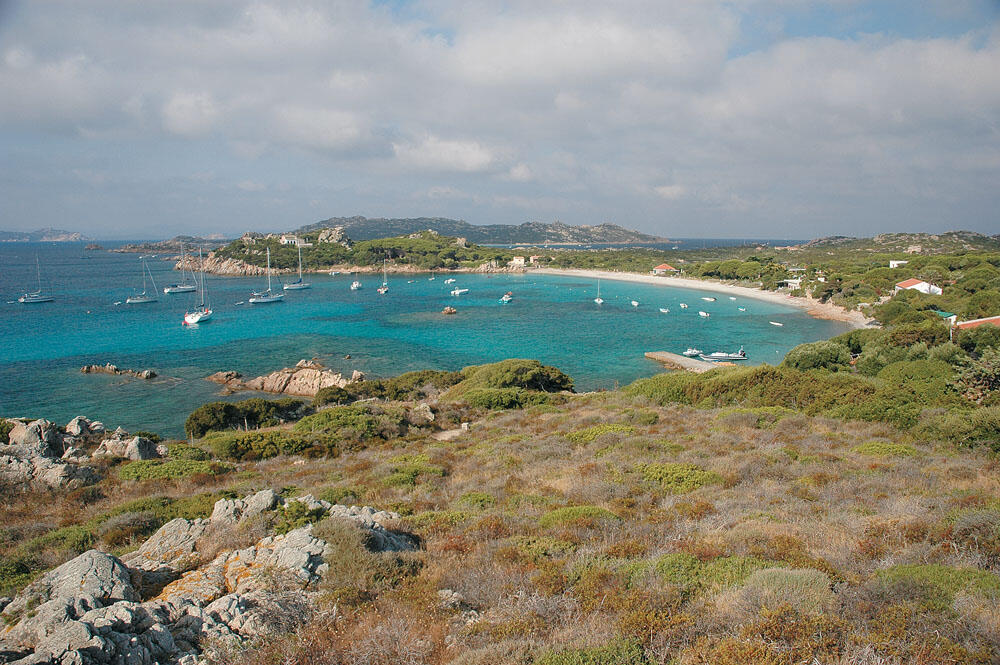
In a few minutes we found ourselves sailing to the famous La Maddalena archipelago, which lies a breath away from the north-east coast of Sardinia, down the Straits of Bonifacio. Seven islands and 55 islets make up this archipelago, which since 1994 has been declared a national park, a protected area for rare mammal species and birds, but also a wonderful travel destination (see related insert).
At first we were confused and didn't know where to start our wanderings.
Finally, we let our instincts guide us, and our bow turned to the narrow channel that separates Maddalena Island from Caprera Island.
Sailing very close to the western shores of the island of Caprera, we entered every cove and observed these places that were unknown to us.
Caprera Island, is the second largest island of the archipelago (with its highest peak reaching 212 meters), and is known as the island of the legendary Giuseppe Garibaldi, father of the Italian revolution, who spent the last years of his life here.
An elevated causeway built in 1891, over a six hundred meter long dam, connects the islands of Caprera and Maddalena, leaving a narrow opening under the bridge where passing boats pass. A little further, from where this highway ends on the island of Caprera, is the house where Garibaldi lived, known as Casa Bianca, which is now an important museum that many people visit every day.
And the island may have associated its name and fame with Giuseppe Garibaldi, but it is also worth visiting for its coast, where some of the most beautiful beaches of the archipelago are hidden.
South of the little cove of Coticcio are two wonderful, very small beaches, with crystal clear waters, and we will be very lucky if we manage to anchor near them. It's so beautiful here, the locals have renamed the place 'Tahiti'!
In the southeast of the island, on the isthmus that leads to Cape Rossa, is the twin coast of Due Mari where a lot of people gather. On the eastern side of the isthmus is the bay of Cala Portese, with its magnificent all-white sandy beach. From here we can take the path that runs east and after a few minutes it takes us to Relitto Beach, an incredible coast with wonderful waters that will fascinate us. Here are also the remains of an old wooden schooner that was wrecked many years ago and is now an attraction for visitors.
Very close to the Relitto coast is the well-shaped Cala Andreana bay, with equally wonderful waters ending in a wonderful fine-grained sand beach.
On the homonymous island
After our short wander in Caprera we decided to visit Maddalena, the largest island of the complex, from which the name of the archipelago comes.
Crossing the narrow channel between the islands of Maddalena and Caprera, we slowly passed under the low iron bridge, which actually connects these two islands. We intended to circumnavigate the island of Maddalena and, sailing along its western shores, arrive at its harbor on its southern side.
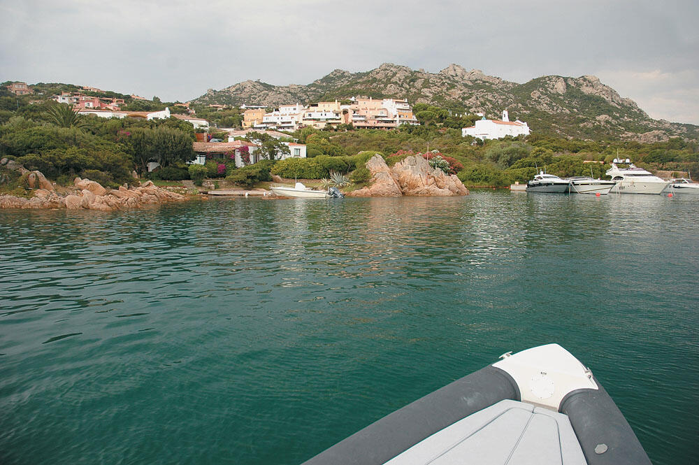
We thus headed towards the north-eastern tip of the island, and soon reached the cove of Cala Lunga.
It is a fairly deep bay, with green waters, which is a very good and safe place to spend the night. Its strong point, however, is that on its northern side is the magnificent Porto Massimo marina, which is surrounded by an amazing hotel complex in the form of a small picturesque village.
The Porto Massimo marina is particularly elegant, very nicely laid out, with all the modern facilities for pleasure boats. With approximately 200 berths, it offers water, electricity, bathrooms and toilets, but without the possibility of refueling. The houses of the hotel complex are amphitheatrically built into the slopes of the low hills, and painted in earthy colors to match the surrounding crimson rocks.
A small alley runs along the left side of the marina, alongside the pretty houses of the 'settlement', which are filled with colorful flowers and lovely bougainvillea. In this alley we find a series of palm trees which, together with the small cafe tables that are under their shade, make up a very beautiful and attractive image.
So after mooring at the long pontoon that lies between the marina and Cala Lunga, and which is set up to welcome the boats of visitors who intend to stay temporarily, we headed to the little cafe and enjoyed our espresso, charmed by the unique setting and the absolute peace of this place.
Although this place is entirely artificial, consisting of the cottages of the hotel complex, the private marina, the cafe and a single mini-market for the necessary supplies, it is altogether a wonderful place, a perfect example of elegance and taste. In addition, due to its location, it is an ideal starting point for daily excursions to the surrounding islands. In fact, the hotel's prices are very affordable, so we can stay in one of its independent houses and have the boat in front of us, tied up in the wonderful marina.
Another important advantage is that the marina is connected to local buses that run every hour to the port, which is about six kilometers away, and to the neighboring island of Caprera.
After spending enough time strolling the streets of the "settlement" and the floating platforms of the marina, we unanimously agreed to return at dusk, and since there was of course no room available, we would spend the night again on the inflatable, anchored in the calm waters of the Cala Lunga bay .
The islands of the Maddalena archipelago are essentially the highest points of the plain that once connected Sardinia with Corsica. The main and largest islands of the archipelago are divided into two groups: the southern one, which includes the islands of Maddalena, Caprera, S. Stefano and Spargi, and the northern one, located two nautical miles above, at the height of the Strait of Bonifacio, and includes the islands of Budelli, S. Maria and Razzoli.
These islands have been a very attractive destination for many years and of course this is no coincidence, since some of the most beautiful beaches of the Mediterranean are hosted here.
The crimson granite rocks of the islands, and the innumerable coves that often end in white sandy beaches with enchanting turquoise waters, compose images with exotic colors that are rarely seen. If we add to all this the particularly close distance between them, where you can wander even with a small boat, and the successive leeward bays that are perfectly protected from the maistro - the main summer wind in these parts - then it is automatically explained why the Maddalena archipelago is flooded with countless yachts and is the busiest maritime area of the Mediterranean. Without a doubt it is the ideal destination for a boating holiday, and if we get the chance to wander these waters in June or September, then we are sure to be so enchanted that we will hardly ever be able to get them off our minds.
Getting to know the Island
So we anchored the northern cape of the island, immediately after which the large bay of Stagno Torto opens. Inside this cove, which is surrounded by low hills, several excellent sandy beaches are formed, with very beautiful and transparent waters. However, it gathers a lot of people, since the road runs at a very short distance from the shores and circles the entire bay.
To enjoy these beaches we must visit them in the morning hours, and of course on a day when the maistros will not blow and the waters will be calm.
In about the middle of the western side of the island we find the open bay of Cala Maiore, at the tip of which is the famous Bassa Trinita coast. Its pure white sand and crystal clear waters are the reasons why this coast is at the top of preferences, for locals and visitors alike. Two miles further south we come across the cove of Cala Francese, the entrance of which faces south, offering a very good anchorage sheltered from the west and north-west winds. It is a very beautiful bay that offers an overnight stay, especially if we approach its northwest side where there is a small concrete jetty.
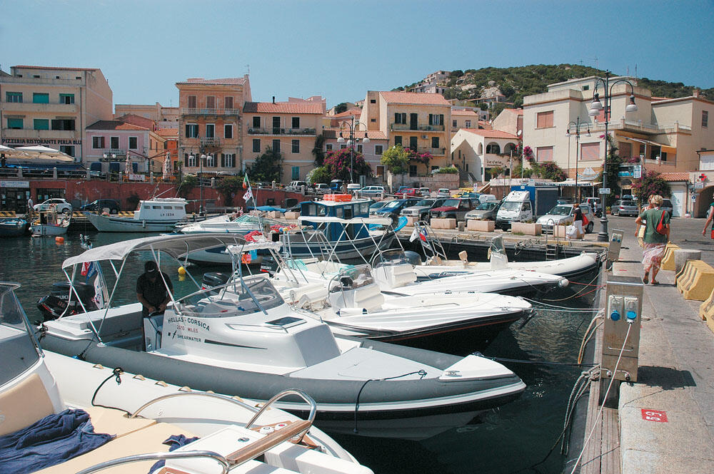
Turning to the south side of the island, at the beginning of the narrow channel formed by the islet of S. Stefano, is the bay of Cala Gavetta which is the old harbor of the town of Maddalena. The first houses of the village were built around this cove, which later expanded to the northeast and turned into a small town. It is a pleasant and lively long narrow harbor surrounded by very beautiful buildings.
Even before we enter through its narrow entrance, we realize that here beats the heart of the island, but also of the entire archipelago. Immediately to the left of the mouth of the port, in a large and comfortable space, is the gas station.
We tacked and after filling up with fuel, we headed to the bottom of the harbor which is also its narrowest point. There, there is a limited area where pleasure boats are allowed to moor temporarily. Of course, at this time it is very difficult to find a free position, but it is worth the effort to persevere. On the left side of the harbor there are four floating platforms, but they are permanently occupied by local boats. On its right side is the quay, which is full of large boats.
With a little effort, we squeezed between some inflatable Italians and thus had the opportunity to go out for a short walk. Via Garibaldi, the main cobbled pedestrian street starts from the port, which takes us to the central Umberto square. This pedestrian street is full of shops, restaurants and cafes, where a lot of people gather.
After buying some souvenirs, we arrived at the main square where the large and impressive building of the City Hall dominates. Directly opposite its entrance is a beautiful cafe, where we sat down for an invigorating coffee. The stone-paved pedestrian street continues past the Town Hall, passing between wonderful two-story houses, where the small iron balconies and the traditional green and brown shutters stand out. The ground floors of these houses host the tourist shops, which are filled with passers-by. This beautiful pedestrian street eventually leads to the eastern side of the city where the commercial port is located.
The coastal road passes from here, along which there are large pedestrian streets with restaurants, cafes and pizzerias. The impressive high-rise buildings around, which, however, maintain the traditional architectural lines, as well as the large palm trees on the beach give the impression of a modern and bustling city.
In the early afternoon we left the mouth of Cala Gavetta and turned towards the eastern side of the island. All too soon we arrived at our beloved Cala Lunga, where we intended to spend the night, and headed out for our final walk to the Porto Massimo marina.
It is the core of the archipelago of the same name and is separated by narrow channels from the rest of the islets that surround it, while it is only one nautical mile from the northeastern coast of Sardinia. Its circumference does not exceed 13 nautical miles, and its strongly lacy coastline forms bays of great depth, in some of which there are wonderful beaches.
It is the only island that is actually inhabited, and the town - where most of its 12,000 inhabitants live - is located on the southern side, a few hundred meters across from the islet of S. Stefano. It is a lively city, built between the bays of Gavetta and Chiesa, which gathers a lot of people in the summer months. Unlike the other islands, here you will find everything: hotels and rooms for rent, many shops, restaurants, cafes and beautiful squares.
Tourist boats leave the port constantly, taking people to the surrounding islands and the nearby Sardinian coasts. The city is also known as "Little Paris", and it is definitely worth wandering through its alleys.
On the islet of Sparghi
The next day, after having an unforgettable breakfast in the small cafe of the Porto Massimo marina, we set sail for the islet of Spargi. It is the westernmost island of the southern group of the archipelago, and is separated from Maddalena by a channel of one nautical mile. With an almost circular shape, it is the third largest island and hosts some of the most beautiful coasts of the archipelago.
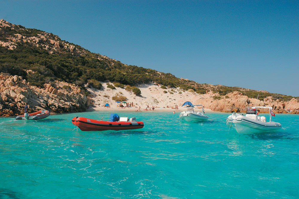
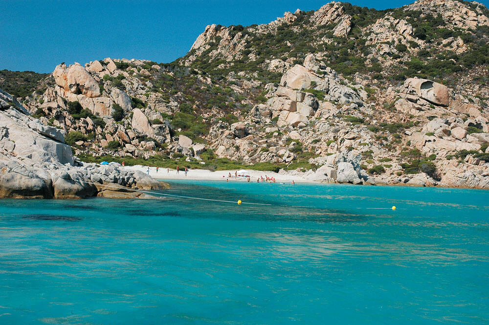
We headed to its southern side, where the famous Cala Corsara is located. It is a wonderful bay, at the mouth of which three independent beaches are formed, surrounded by beautiful low rocks, and are covered with white fine-grained sand. The waters in the entire area of the bay have a unique turquoise color, which fascinates you from the very first glance.
Very soon, the first tourist boats began to appear, while the peaceful bay was suffocatingly filled with so many boats, that it gave the impression of a large marina.
Satisfied that we had managed to live, if only for a little while, alone in this unique cove, we turned and tacked Punta Rossa Corsara.
On the southeast side of the island are three more amazing beaches in a row: Cala Granara, Cala Conneri, and the unique white sandy beach of Rena Bianca, which rises for several meters on the low slope, and is divided in two by a large rock that juts out to the sea. All of them are magnificent, with crystal clear waters that reflect all shades of blue, creating a feast of colors.
We passed very carefully among the dozens of boats anchored near these shores, so that we could admire the unique colors of the waters. The only way to enjoy the above beaches is to visit them early in the morning, before the hordes of boats start arriving. The entire southern and southeastern part of the island of Spargi is dotted with heavenly sandy beaches that should not be missed in any way.
In the northern cluster of the archipelago
It was not yet midday and our bow turned 1.5 miles further north, where are the three small islets of Budelli, Santa Maria and Razzoli, which make up the northern cluster of the La Maddalena archipelago. These islets are very close to each other and are separated by very narrow channels that, in some places, do not exceed 60 meters.
They are characterized by strongly laced coasts, which form many deep bays. Here we will encounter some of the most enchanting beaches, which have made this archipelago famous. Hundreds of pleasure boats approach these three small islands every day, but fortunately there are very few that stay after sunset.
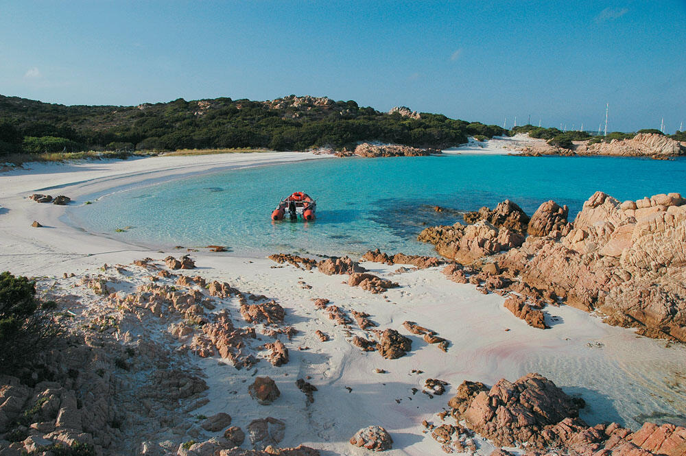
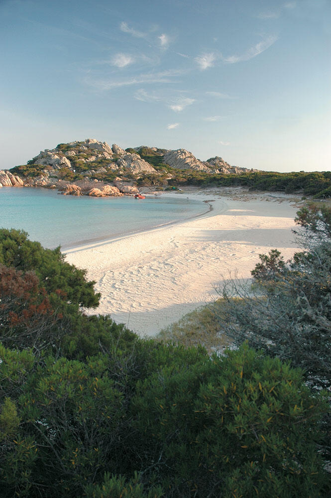
And of course we headed first to the islet of Budelli, at the southeast end of which is the most famous coast of the archipelago and, for many, one of the most enchanting in the entire Mediterranean. And it is none other than the famous Spiaggia Rosa or otherwise Pink Beach. Its name as well as its reputation are due to the shells and corals damaged and crushed by the sea, which give an incredible pink shade to the sand, in the places where the sea licks the shore (a phenomenon that we also find in Elafonisi, Crete).
Otherwise it is a very beautiful and well-formed coast, with all-white sand and wonderfully clear waters. It is located at the mouth of a small and quite closed bay, which is surrounded by very low hills, covered with bushy vegetation.
We dinghy approached the mouth of the cove, but a row of buoys barred recreational boats from entering.
Roz beach is completely protected. Not only is swimming not allowed, but even walking on the beach is prohibited.
From the entrance of the cove, however, we couldn't admire Spiaggia Rosa, so we ended up in the cove that is right above.
From here begins a narrow but distinct path, which progresses through low bushes and soon brings us to the famous coast. Just behind the sandy beach, hidden in the bushes and few trees so as not to be seen, is a wooden shack where a man lives who is probably responsible for the surveillance of the beach.
We skirted around the deceptively white sand, access to which was barred by a wooden fence, and reached the top of the bay's southern cove. Here is also the highest point, from where we could have a more panoramic view of the Pink Coast. As long as I was standing and admiring this coast, the amazing images of our own Pink Coast, there in Elafonisi in the west of Crete, passed through my mind. But the images of Elafonisi as it was several years ago. Because now it's filled with plastic sunbeds and canteens, and you now need a microscope to distinguish the unique pink color of the sand.
On the contrary, the neighboring Italians made sure to prohibit access from both land and sea to their own Pink Coast, which they characterized as an area of unique natural beauty. Which of course acted as a very powerful advertisement for the whole area and thus the reputation of the beach took off, resulting in many visitors coming to these places just to see the Pink Coast up close.
The turquoise waters of Porto Madonna
A little above the Pink Coast, where the three islands of the complex are very close to each other, a large lake-like sea area is formed, with amazing emerald waters. A natural pool, called Porto Madonna, with very shallow and transparent waters, which have an incredible turquoise hue. Colors and images that remind us of distant tropical paradises.
Porto Madonna is one of the most attractive and popular spots of the archipelago, where many pleasure boats crowd every day, making it difficult to find a free space to drop our anchor. At dusk, however, most boats depart and we can enjoy this special place without fuss, where we can even spend the night in its calm waters, which offer safety in all weathers. The most beautiful place to spend the night is located a few meters further west, in the north-eastern part of the islet of Budelli, next to the long, all-white sandy beach of Cavaliere beach. Waking up in the morning and swimming in these enchanting waters, before the tourist boats arrive, will surely be unforgettable.
Santa Maria Island
We carefully passed the scattered rocks and islets which lie between Budelli and Santa Maria, and, covering a distance of one nautical mile, entered the bay of the same name of Santa Maria, to the south-east of the island. It is a large circular bay with very beautiful waters, at the end of which a wonderful sandy beach stretches for a long time. Just behind the sandy beach are several cottages, nestled in the low vegetation. Santa Maria is the only island of the three in the northern complex of the Maddalena archipelago, on which we find some houses. The rest are completely uninhabited.
We headed to the northeast side of the cove and tied up at the stone dock located there. From its base starts a wide, dirt path, which leads after a kilometer of the route, to the lighthouse of Punta Filetto, at the eastern end of the island.
We took the path which took us to the top of the low hill, from where we had a panoramic view of the bay of S. Maria, the surrounding islets and the narrow channels that form between them.
The path then becomes very narrow and, after a very beautiful drive through the thick undergrowth of low pines, in about twenty minutes, brought us out to the abandoned lighthouse building of Punta Filetto.
After our pleasant walk, we returned to the cobbled dock where we had left the inflatable. We walked along the fine sand, noticing the beautiful cottages that were really well kept. We chatted for a while with some of the elderly owners of these houses, who were polite, their faces radiating a characteristic calmness, and after they generously gave us the information we wanted, we greeted them and returned to the inflatable.
Razzoli Island
We returned to Porto Madonna and headed to the south side of the narrow passage that lies between the islands of S. Maria and Razzoli. This channel is called Passo degli Asinelli and is only sixty meters wide. Its depth does not exceed seventy points, a fact prohibiting the passage of large vessels and of course sailboats. Very carefully, with the propeller catching more wind than sea, we slowly crossed this narrow and shallow passage and turned to the east side of Razzoli Island.
The whole of this coast line is extremely rocky, and the little coves formed between the brown rocks are devoid of sandbars. Arriving at the northern end of the island, we stood for a while under the imposing lighthouse, and the impressive, but deserted, four-story building next to it.
All declaring a desire to visit this lighthouse, we turned our bow towards the western side of the island, where the extremely deep Cala Lunga bay is located.
Entering its sothikas, the further we went, the narrower it became, while it began to be completely embraced by the punentis, despite the fact that its open entrance faces west. At the bottom of the bay two small beaches are formed, of which the one on the northern side stands out. Lined with sand, next to the calm green waters, it is a wonderful refuge, both from the weather and from the hordes of tourists, since it manages to remain deserted even at this time of year.
Before the above two beaches, exactly where the Cala Lunga cove begins to narrow, there is a small dock made of large stones in the shape of a cube, strongly reminiscent of an ancient construction. From the dokaki starts a narrow lane that crosses the mountainous mass of the island, which is strongly rocky (with only some places of low bushy vegetation), and leads to the northern end of the island, where the impressive lighthouse is located. After about half an hour of driving, in a barren but impressive landscape dominated by strange formations of brown rocks, we arrived outside the large square building behind the lighthouse.
The building's abandoned restoration scaffolding was rusted, as rusted and corroded by grime and time was everything inside it. It looked ready to collapse, but we climbed up its circular internal staircase and reached the roof. We were so high that the large and impressive stone lighthouse was much lower than our level.
The view from here is excellent as the Strait of Bonifacio stretches to the west, while the Lavezzi islets belonging to Corsica are clearly visible.
The wild beauty of this place had fascinated us and so we decided to spend the night on the deserted coast at the bottom of Cala Lunga. This would also be our last night in the waters of Sardinia and the La Maddalena archipelago.
Hunched over local maps we made our plans for our next stop, the Lavezzi Islands. From the next day, we would be wandering in now French seas, and we had to forget whatever Italian we had learned so far...
...keep Ribbing!